Plot Finder – land parcel identification system
LPIS is the Land Parcel Identification System of reference for all farmers in Europe. It was created to facilitate the management of farms, but today it has become a daily tool for any farmer. Required mainly for:
- Farm management
- Phitosanitary and Fertilization reports
- Contracting for Agricultural Insurance
- Contracts for Rural Leases

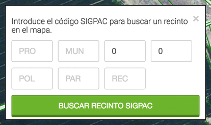
Using a Plot finder or a plot locator
Finding LPIS plots is an action that any farmer does virtually every day. The official applications or softwares from administrations are the ones that everyone knows about, but when you use it you will have encountered drawbacks like these:
- It is not very intuitive.
- Slow loading.
- Display not adapted to mobile phone browsers.
- It does not allow saving plots of your farm.
SIGPAC plot locator on your mobile by GPS
If, for you, it is essential to access to view LPIS plots from anywhere (while you are working in the field, when you come from insurance to survey a plot or when you are in the bank processing bureaucratic procedures), with the Agroptima APP you have it easier than ever. See what you can do:
- Open the map / plot locator finder through the app.
- Fast and from the mobile device.
- Mark the site you want to consult.
- Save it with the name of the place to retrieve it later.
- Put the crop sown or planted to see your fields painted by colors according to the crop.
- Register all the operations or treatments and then have your reports done alone.
.png?width=414&height=257&name=image3%20(1).png)